Mae Hong Son
Thailand's misty northwest province — the Mae Hong Son Loop, lakeside temples, Su Tong Pae bamboo bridge, and an honest look at long-neck village visits.
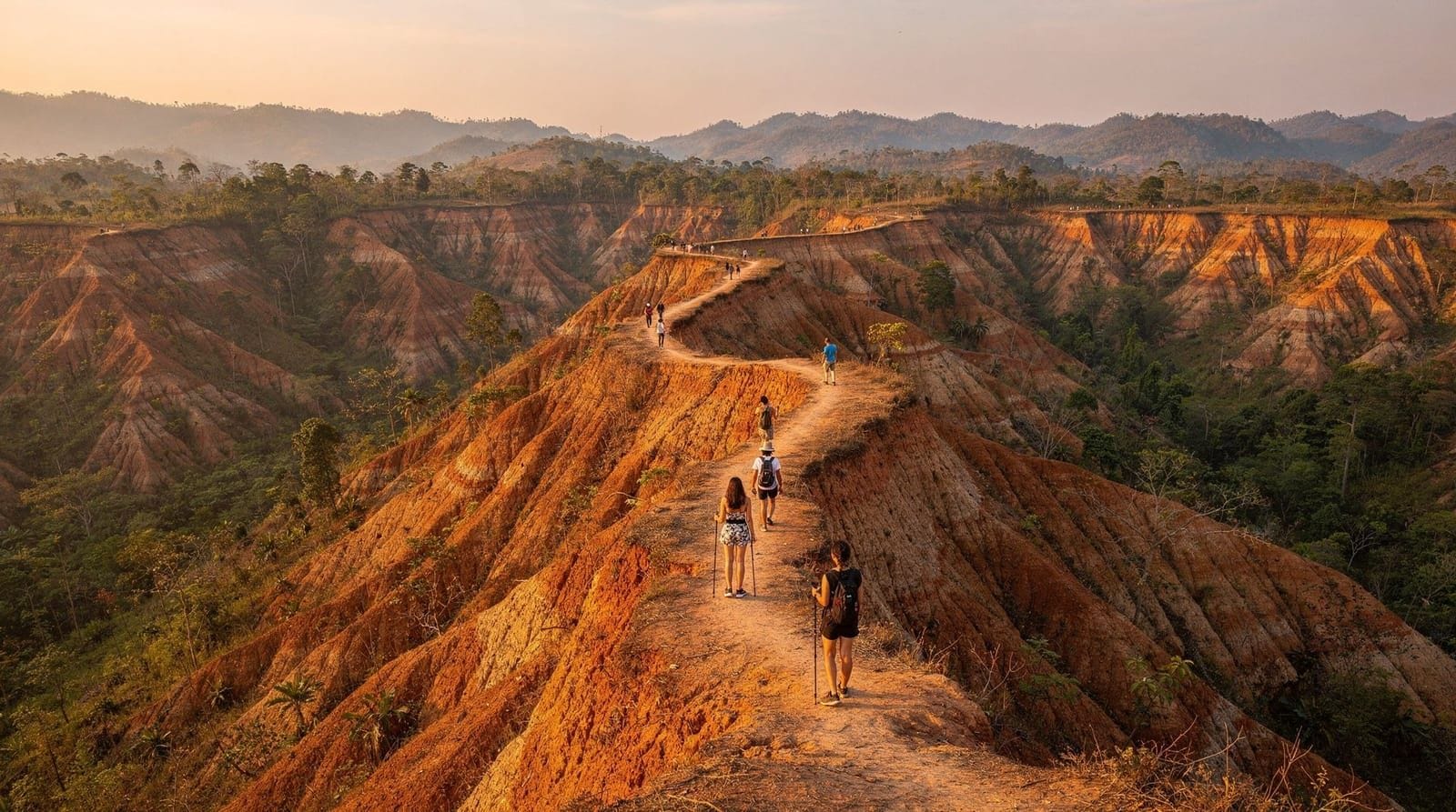
From Pai: Private Mae Hong Son Highlights Car Tour
Duration: Full day
Quick facts
- Distance / time
- ~270km from Chiang Mai direct (~6-7 hours by road), or the full loop via Pai (~600km / 3-4 days)
- Getting there
- Minivan, private car/driver, self-drive, or short domestic flight to Mae Hong Son airport
- Key sights
- Wat Chong Kham & Wat Chong Klang, Su Tong Pae bamboo bridge, Ban Rak Thai, Pang Ung, Fish Cave
- Days needed
- 3-4 days for the full loop from Chiang Mai; a direct visit to town alone can be done in 2 days
- Best time
- November-February for cool, clearer mist-and-mountain conditions; roads can be affected in the wet season
Mae Hong Son is the province, and the small provincial capital of the same name, tucked against the Myanmar border in Thailand’s far northwest. It’s nicknamed “the city of three mists” — a reference to the fog that regularly settles over the surrounding mountains from cool-season nights, seasonal agricultural burning, and cloud cover — and that nickname is a fair summary of what sets it apart from anywhere else covered in a Chiang Mai itinerary: this is genuinely remote, deeply mountainous terrain, reached by some of the most physically demanding driving in the region.
Quick answer: Mae Hong Son is best known as the far endpoint of the Mae Hong Son Loop, a roughly 600km mountain circuit from Chiang Mai through Pai, Mae Hong Son town, and back, usually done over 3-4 days. On its own, the provincial capital offers lakeside temples (Wat Chong Kham and Wat Chong Klang), the Su Tong Pae bamboo bridge outside town, and access to remote villages and viewpoints like Ban Rak Thai and Pang Ung — but it’s a genuine long-haul destination, not a quick add-on to a Chiang Mai city stay.
The Mae Hong Son Loop
The loop is the standard framework almost everyone uses to plan a visit: Chiang Mai to Pai (about 3-3.5 hours via the 762-curve Route 1095), Pai to Mae Hong Son (a further 2.5-3 hours on an equally winding mountain road), and Mae Hong Son back to Chiang Mai directly (roughly 6-7 hours via Route 108, passing through Khun Yuam and Mae Sariang). Done in full, it’s around 600km of driving, almost entirely on mountain roads with continuous curves, and realistically needs 3-4 days to do without exhausting yourself or the driver.
Most travelers either self-drive with real mountain-driving experience, hire a private driver for the whole loop, or break it into guided day segments — a Mae Hong Son highlights private car tour departing from Pai is a practical way to cover the Pai-to-Mae Hong Son leg without committing to self-driving the most demanding section of the route. See the Pai guide for the first leg of the loop in detail.
Getting there without the full loop
For travelers who want Mae Hong Son itself without the multi-day loop, a direct road journey from Chiang Mai via Route 108 through Mae Sariang takes roughly 6-7 hours, still on winding mountain roads but a more direct single leg than the Pai detour. A short domestic flight connects Chiang Mai and Mae Hong Son in well under an hour and is a realistic option for travelers with limited time who still want to see the province without days of driving, though flight schedules are more limited than the Pai route and worth confirming well in advance.
Wat Chong Kham and Wat Chong Klang
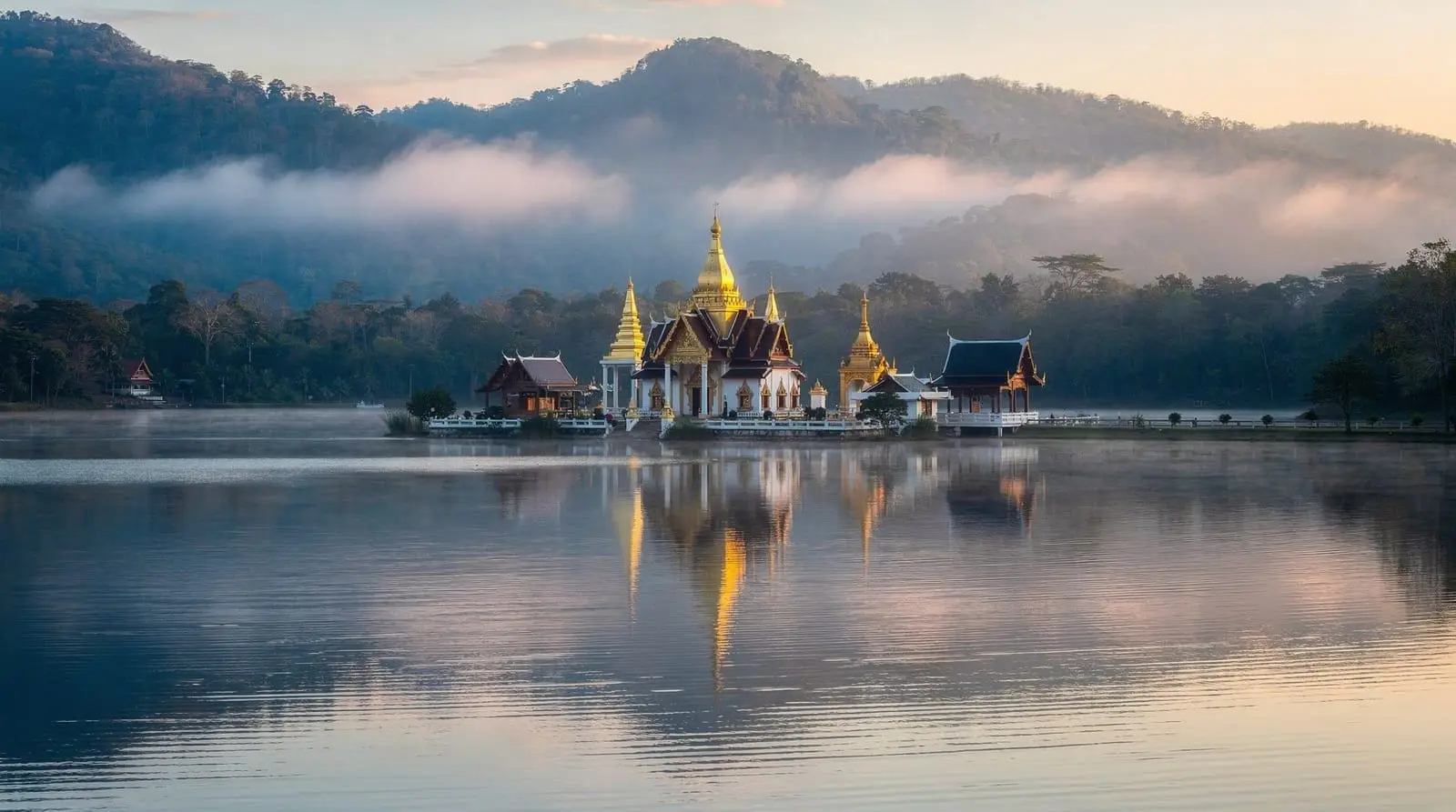
The two temples sit side by side on the edge of Nong Chong Kham, the small lake at the center of Mae Hong Son town, and together form the most photographed single view in the province — their reflections in the lake water, especially around sunset and during the cool-season mist, are the image most associated with the town. Wat Chong Kham, the older of the two, dates to the late 18th century and shows clear Shan (Tai Yai) architectural influence, reflecting the region’s historical ties to Shan State across the nearby Myanmar border more than to central Thai temple styles. Wat Chong Klang, next door, holds a notable collection of glass paintings depicting Buddhist Jataka tales, along with wooden and glass figures brought from Myanmar generations ago.
Both temples are free to visit and easily combined with an evening walk around the lake, which is the town’s natural gathering point and where much of Mae Hong Son’s modest evening market activity concentrates.
Su Tong Pae bamboo bridge
A short drive outside town, the Su Tong Pae bridge is a long bamboo-and-wood footbridge built by a local monk and villagers, running across rice paddies to connect a village with a nearby temple where monks walk each morning to collect alms. Like Pai’s better-known bamboo bridge, it’s become a popular sunrise and late-afternoon photo stop, with the surrounding rice fields (green in the growing season, golden at harvest, bare and dry otherwise) changing the scene substantially depending on when you visit. Morning visits, ideally shortly after sunrise, catch both the mist typical of the region and the possibility of seeing monks crossing the bridge as part of their regular alms round — a moment worth being quietly respectful around rather than treating purely as a photo opportunity.
Ban Rak Thai
Up in the hills near the Myanmar border, Ban Rak Thai is a Yunnanese Chinese village founded by Kuomintang soldiers who settled in the area after China’s civil war, and it has developed a distinct identity built around tea cultivation, Yunnanese cuisine, and a lake-facing view that draws a steady stream of visitors, particularly during the cool season when the surrounding hills are at their most scenic. Tea houses along the lake serve local Chinese-style teas and dishes distinct from anything you’ll find in Chiang Mai proper, and the village makes a worthwhile stop for travelers curious about the province’s genuinely mixed ethnic and historical makeup rather than a single “hill tribe” narrative.
Pang Ung and Fish Cave
Pang Ung, sometimes marketed as “the Switzerland of Thailand” in domestic tourism material (an exaggeration worth taking with a grain of salt, though the pine-forest lake setting is genuinely scenic), is a reservoir surrounded by pine trees near the Myanmar border, popular for cool-season camping and misty morning photography. Tham Pla, the Fish Cave, is a shallow spring-fed pool near a cave entrance a short drive from town, home to a resident population of large carp considered sacred by nearby communities — a modest, easy stop rather than a major attraction, but a pleasant short walk if you’re passing through the area.
Long-neck Karen villages: an honest look
Several tour itineraries in the Mae Hong Son area include a stop at a “long-neck” Karen (Kayan) village, where women wear brass neck coils as part of a traditional practice. This is one of the more ethically complicated stops in the entire region, and it’s worth understanding before booking rather than treating it as a routine village visit. Many of the Kayan communities living in these villages are refugees from Myanmar, and several villages operate on a paid-entry model that has drawn documented criticism for functioning closer to a human-zoo arrangement than a genuine cultural exchange, with limited freedom of movement for some residents and entry fees that don’t always clearly or transparently benefit the community itself.
There’s no single clean answer here. Some visitors choose to skip these stops entirely on principle; others visit only with operators who can speak specifically to how entry fees are used and how the community’s situation and freedom of movement actually work, rather than accepting a vague reassurance. If a tour itinerary you’re considering includes a long-neck village stop, it’s worth asking the operator directly, before booking, exactly how the visit is structured and where the fees go — a hesitant or vague answer is itself useful information.
When to go
November through February is the clearest, coolest window, when the “three mists” nickname is most literally true — cool nights produce genuine morning fog over the lake and surrounding rice fields, adding to rather than obscuring the scenery. February through April brings the same agricultural burning haze that affects the wider region, which can dull mountain views and, in worse years, affect air quality noticeably. The wet season (roughly June-October) brings lush green hillsides but carries real risk of landslide-related road closures on the mountain routes, worth checking before committing to a self-drive loop in that window.
A brief history of the region
Mae Hong Son province’s history is closely tied to its border position: the town itself was founded in the mid-19th century initially as an elephant-training outpost for the Chiang Mai kingdom, later developing as a trading link with Shan State communities across the border in what is now Myanmar. That Shan influence remains visible in the province’s architecture — most clearly in Wat Chong Kham’s design — and in local food, language, and festivals, which lean noticeably more toward Shan and Burmese traditions than the Lanna character of Chiang Mai itself. The 20th century added further layers: Kuomintang Chinese settlement (visible today in villages like Ban Rak Thai), and, more recently, movement of Kayan and other refugee communities from Myanmar’s ongoing conflicts, which is the background behind the long-neck village question addressed above. Understanding this layered, genuinely border-region history is useful context for why Mae Hong Son feels distinct from anywhere else in a typical Chiang Mai itinerary — it isn’t simply “more remote Lanna,” but a province shaped by a different, more mixed set of historical influences.
Suggested itinerary for the full loop
A workable 4-day version of the loop: day one, Chiang Mai to Pai, settling in for the evening market; day two, Pai sightseeing (canyon, hot springs, bamboo bridge) with an early departure toward Mae Hong Son the next morning; day three, drive from Pai to Mae Hong Son town, arriving with enough afternoon light for the lake temples and, ideally, sunset there, with Su Tong Pae bridge or Ban Rak Thai as a half-day add-on if time allows; day four, the long drive back to Chiang Mai via Mae Sariang, ideally starting early to avoid arriving after dark on unfamiliar mountain roads. Travelers with only 3 days can compress by skipping either the Ban Rak Thai detour or a full day in Pai, but compressing the driving days themselves is not recommended given the demands of the road.
Practical notes
Mae Hong Son town is small and walkable, centered on the lake, with a modest range of guesthouses and small hotels rather than large resort-style properties. ATMs and basic services are present in town but thin out quickly once you’re outside it, so carrying more cash than you would in Chiang Mai is a reasonable precaution for the more remote legs of the loop. Fuel stations are less frequent on the mountain roads between towns, so it’s worth topping up whenever you pass one rather than waiting until the tank runs low, particularly if self-driving.
How Mae Hong Son compares to Pai and Chiang Dao
Of the four northern day-trip areas covered in this section, Mae Hong Son is the most remote and the most demanding to reach, which is also its main appeal for travelers who’ve already done the more accessible stops. Pai offers a similar mountain-town atmosphere with considerably easier access and a more developed backpacker and café scene; Chiang Dao, just 1.5 hours from Chiang Mai, offers a genuine mountain-nature outing without any of the multi-day commitment. Mae Hong Son suits travelers who have the time for the full loop and want the least commercialized, most genuinely remote version of northern Thailand’s mountain scenery — not travelers looking for a quick escape from the city.
Food and local specialties
Mae Hong Son’s food scene reflects its Shan and Yunnanese influences more than typical northern Thai cuisine found in Chiang Mai. Khao soi still appears on menus, but so do Shan-style dishes like tua nao (fermented soybean discs, used similarly to how central Thailand uses shrimp paste) and a wider range of pickled and fermented vegetable side dishes than is typical further south. In Ban Rak Thai specifically, Yunnanese Chinese tea-house food dominates — steamed buns, tea-smoked dishes, and the province’s own tea leaves, grown on surrounding hillsides and sold in small shops around the village. Morning markets in Mae Hong Son town are a good, low-cost way to sample this local mix before a day of sightseeing, generally busiest and freshest before mid-morning.
Accessibility and travel comfort notes
Given the mountain-road nature of nearly every route into and around Mae Hong Son, travelers with motion sickness sensitivity, mobility limitations, or simply limited tolerance for long winding drives should weigh this destination carefully against easier alternatives like Chiang Dao. None of the loop’s roads are wheelchair-accessible in the way a flat city street would be, and vehicle-based travel is the only realistic way to reach most sights — walking between attractions in Mae Hong Son town itself is feasible given its small, lake-centered layout, but reaching Su Tong Pae, Ban Rak Thai, or Pang Ung requires a car, driver, or organized tour in every case.
Frequently asked questions about Mae Hong Son
How far is Mae Hong Son from Chiang Mai?
About 270km direct via Route 108 (roughly 6-7 hours driving), or a considerably longer route if following the full Mae Hong Son Loop through Pai, which totals around 600km.
Do I need to do the full loop to visit Mae Hong Son?
No — you can drive directly via Route 108 in about 6-7 hours, or fly, without going via Pai. The full loop is a scenic choice for travelers who have 3-4 days and want the road-trip experience, not a requirement.
What is the Mae Hong Son Loop?
A roughly 600km circuit from Chiang Mai through Pai, Mae Hong Son town, and back via Mae Sariang, usually done over 3-4 days on winding mountain roads.
Is it ethical to visit a long-neck Karen village?
It’s genuinely complicated — many residents are Kayan refugees from Myanmar, and some villages have drawn criticism for exploitative entry-fee arrangements. Ask any operator specific questions about how the visit works before booking, or consider skipping this stop.
What does “city of three mists” mean?
A local nickname referring to fog from cool-season nights, seasonal agricultural burning haze, and general cloud cover that regularly settles over Mae Hong Son’s mountains and valleys.
When is the best time to visit Mae Hong Son?
November through February, for the clearest air and the most scenic version of the region’s characteristic mist. Avoid the June-October wet season if self-driving, due to landslide risk on mountain routes.
Can I fly to Mae Hong Son instead of driving?
Yes, short domestic flights connect Chiang Mai and Mae Hong Son in well under an hour, though schedules are more limited than for Pai and worth confirming ahead of time.
What’s the best single photo stop in Mae Hong Son town?
Wat Chong Kham and Wat Chong Klang together, viewed across Nong Chong Kham lake, especially around sunset or during cool-season morning mist.
Top experiences
Bookable activities with verified prices and instant confirmation on GetYourGuide.