Ping riverside and Wat Ket
The Ping River's east bank pairs a historic temple, a quirky community museum, and Charoenrat Road's galleries and cafés — Chiang Mai without the crowds.
Chiang Mai: Tuk-Tuk City Tour
Quick facts
- Getting there
- Cross the Nawarat or Iron Bridge from the Old City side; 20-25 min walk, or Grab ~40-60 THB
- Key sight
- Wat Ket Karam and its community museum, Charoenrat Road galleries, the Iron Bridge
- Time needed
- 2-3 hours
- Best time
- Late afternoon into evening, for riverside dinner as temperatures drop
- Cost / entry
- Free to walk the riverside and temple grounds; museum donation-based
Cross the Ping River from the Old City side and the pace changes almost immediately. Charoenrat Road and the streets around Wat Ket Karam are where Chiang Mai’s early merchant families — Chinese, Burmese, and European traders working the river trade — actually lived, and the neighborhood still reads as residential first, tourist second.
Quick answer: the Ping River’s east bank, centered on Wat Ket Karam temple and Charoenrat Road, is a quieter alternative to the Old City and Night Bazaar — a strip of restored shophouses, small galleries, and riverside restaurants connected by the pedestrian Iron Bridge. It rewards an unhurried late-afternoon walk rather than a checklist visit.
Getting there
The east bank sits directly across the Ping River from the Night Bazaar and Old City area. The two main crossings are the Nawarat Bridge, a standard road bridge with pavements, and the Iron Bridge (Saphan Lek), a narrower pedestrian and cyclist crossing slightly further north that’s more atmospheric for a walk, especially at sunset. From Tha Phae Gate it’s about a 20-25 minute walk via Nawarat Bridge, or a 40-60 THB (roughly $1.10-1.70) Grab if you’d rather save your legs for the neighborhood itself.
Wat Ket Karam and its community museum
Wat Ket Karam is a working Lanna-style temple, unremarkable in scale compared to Wat Phra Singh or Wat Chedi Luang in the Old City, but notable for what sits beside it: a small community museum housed in an old assembly hall, packed with donated household objects, old photographs, radios, typewriters, and clothing from the neighborhood’s merchant-era families. It’s an unpolished, slightly cluttered collection rather than a curated exhibition, and that’s exactly its charm — it reads as a genuine local memory project rather than a tourist attraction. Entry is donation-based; there’s no fixed ticket price.
Charoenrat Road: galleries, cafés, and old shophouses
Running parallel to the river, Charoenrat Road is lined with restored teak shophouses, several of which now host small independent galleries, boutique guesthouses, and cafés. This is a good stretch for slow browsing rather than must-see stops — a gallery might be closed on a given afternoon, a café might have a queue, and neither is worth stressing over given how short the street is. The atmosphere, more than any single address, is the draw: fewer vendors calling out, fewer other visitors, and river views between buildings.
Riverside dining
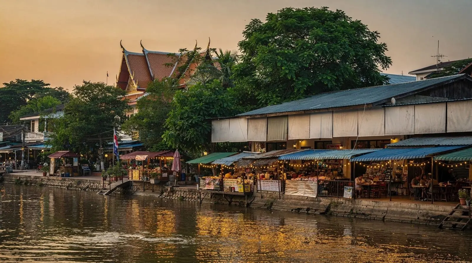
Evening is when this stretch earns its keep. Restaurants along both banks near the Nawarat and Iron Bridge crossings set up river-facing terrace seating, and the temperature drop after sunset makes outdoor riverside dinner genuinely pleasant for much of the year (November through February especially). Expect a mid-range price point — noticeably above street food, but well below the international hotel restaurants clustered near the river’s luxury properties. Reservations aren’t generally necessary outside major holidays, but arriving before 7pm secures the better river-view tables.
The Iron Bridge at sunset
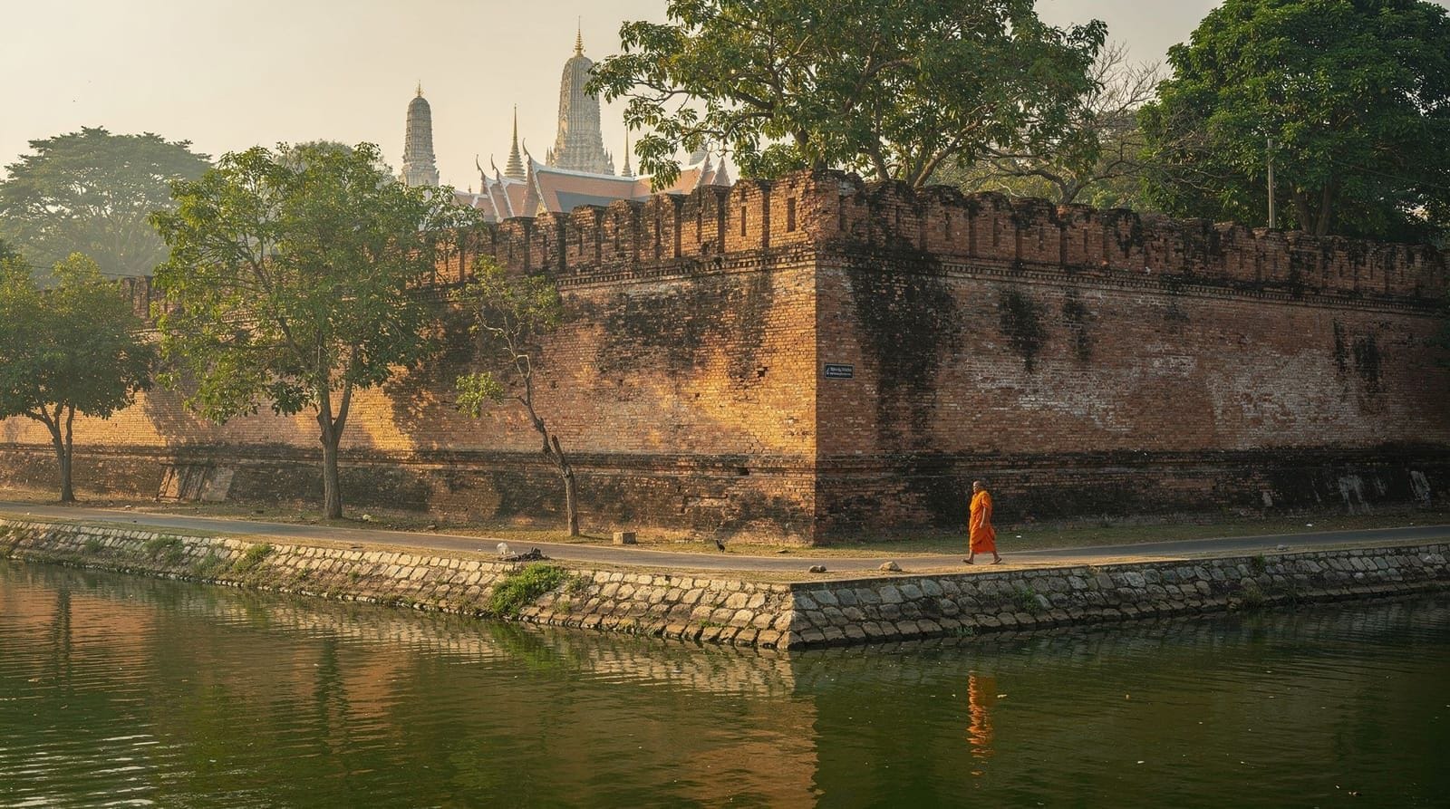
Saphan Lek, the pedestrian Iron Bridge, is a modest steel-truss crossing but a genuinely good sunset spot — low enough to the water to feel connected to the river, free of vehicle traffic, and far enough from the Night Bazaar crowds to feel calm. It’s a five-minute stop rather than a destination in itself, but worth timing your walk to cross it around golden hour.
Seeing the riverside as part of a wider city tour
Because this neighborhood isn’t built around a single ticketed attraction, most visitors reach it on foot as an extension of an Old City or Night Bazaar day rather than as a dedicated outing. If you’d prefer to see it woven into a broader city overview with a guide who can point out the merchant-era history as you go, a tuk-tuk city tour or guided city bicycle tour typically threads through this side of the river alongside the Old City’s main temples. For a shorter, photography-focused option, an instagrammable spots half-day tour often includes riverside and shophouse backdrops similar to Charoenrat Road.
Combining with Warorot Market
The east bank sits close enough to Warorot Market that the two combine naturally into a single morning-to-evening loop: Warorot early for food and flowers while it’s cool, a late-morning or afternoon crossing to Wat Ket and Charoenrat Road for galleries, then a riverside dinner as the sun goes down. It’s a lower-effort, lower-cost day than a Doi Suthep excursion, and a good choice for a day you want to keep unstructured.
Practical notes
There’s less foreign-language signage here than in the Old City or Night Bazaar, which is part of the neighborhood’s appeal but also means Google Maps or a downloaded offline map is more useful than usual. Pavements along Charoenrat Road are uneven in places — comfortable shoes matter more here than in the flatter, more manicured Old City streets. ATMs are available near the Nawarat Bridge junction but sparser further along Charoenrat Road itself, so withdraw what you need before crossing.
A short history of the merchant quarter
The Ping River’s east bank developed as Chiang Mai’s international trading district during the late 19th and early 20th centuries, when European teak companies, Burmese and Shan traders, and Chinese merchant families settled along the riverbank to manage the timber and goods trade flowing downriver toward Bangkok. Several of the teak shophouses still standing along Charoenrat Road date from this period, built by families who made their fortunes in the logging trade before it was restricted in the late 20th century. Wat Ket Karam itself predates this commercial boom, but the neighborhood’s cosmopolitan character — a mix of Buddhist, Christian, and Islamic community buildings within a short walk of each other — reflects the diversity of traders who once called this stretch of riverbank home. The community museum beside the temple exists specifically to preserve artifacts from this era before they’re lost to redevelopment, which explains its slightly improvised, donation-driven feel compared to a formally funded institution.
A realistic afternoon-into-evening itinerary
A workable sequence for this area starts around 3-4pm, once the day’s heat has started to ease: cross via the Iron Bridge for the more atmospheric approach, spend 30-40 minutes at Wat Ket Karam and its community museum, then wander Charoenrat Road for an hour, popping into whichever galleries happen to be open and stopping for a coffee if the afternoon heat calls for a break. As the light starts to turn golden, around 5:30-6pm, head back toward the Iron Bridge for sunset over the river, then settle into one of the riverside restaurants for dinner as temperatures drop further into the evening. The whole sequence runs 3-4 hours at an unhurried pace, making it a natural way to close out a day that started with temples or markets elsewhere in the city.
Photography notes
The riverside’s appeal for photography lies less in any single monument and more in the accumulation of small details — weathered shophouse facades, the Iron Bridge’s steel trusses against the water, and the river itself catching evening light. Late afternoon and the hour around sunset produce the most flattering light for the shophouse strip along Charoenrat Road, since the street runs roughly parallel to the river and catches warm, low-angle sun rather than the harsher overhead light of midday. The temple grounds at Wat Ket Karam are quieter than the Old City’s major temples, making it easier to photograph architectural details without crowds in frame, though as always, be discreet and respectful around worshippers.
Weather considerations
Because much of this itinerary is outdoors and involves an open-air river crossing, weather matters more here than in covered markets like the Night Bazaar’s food courts. During the rainy season (roughly June to October), afternoon downpours are common but usually brief — waiting one out at a Charoenrat Road café rather than pushing through it is the practical approach, and most galleries and cafés are happy to have you linger. The cool season (November to February) is the most comfortable window for the riverside generally, with mild evenings that make outdoor dining genuinely pleasant rather than just tolerable.
Combining with the Night Bazaar for a full evening
Because this district sits directly across the river from the Night Bazaar, a longer evening itinerary can reasonably combine both: start on the east bank around 4-5pm for the temple, museum, and gallery browsing described above, cross back over the Nawarat Bridge around 6:30-7pm as the Night Bazaar is fully setting up, browse the stalls for 30-45 minutes, then decide whether to eat at Anusarn’s seafood courtyard or return to the quieter riverside restaurants for dinner. This sequencing uses the daylight hours for the calmer, more visually rewarding riverside activities, and the evening hours for the market’s energy, rather than trying to do both simultaneously and diluting each.
Where to stay if the riverside is your priority
For visitors who want this area to be more than a single afternoon excursion, a handful of boutique guesthouses along Charoenrat Road itself, converted from the same teak shophouses that give the street its character, offer a genuinely different base than the Old City or Night Bazaar hotels — quieter at night, closer to the galleries and riverside restaurants, and a short songthaew or Grab ride from everywhere else. The trade-off is being slightly further from the Old City’s temple cluster and from Nimmanhaemin’s café scene, both a 15-20 minute ride away rather than a walk, which matters if you plan to move between neighborhoods frequently during your stay.
Rainy day alternative
If weather cuts a riverside walk short, the community museum at Wat Ket Karam and the indoor galleries along Charoenrat Road both offer covered alternatives that keep the essential character of the visit — local history and small-scale art — intact even when an outdoor stroll isn’t practical. Several cafés along the same stretch have deep, covered seating areas suited to waiting out a downpour with a coffee rather than rushing to the nearest indoor attraction, consistent with the area’s generally unhurried pace.
A note on the galleries specifically
The small independent galleries along Charoenrat Road change over time more than most attractions in this guide — a space that hosted a photography exhibition one season might host textile art the next, or close for a few months between shows. Rather than naming a single gallery as a must-see, the more reliable approach is to treat the street itself as a rotating exhibition space and simply walk in wherever a door happens to be open and a display catches your eye. Most operate on a free-entry, donation-optional basis, consistent with the low-key, unhurried character of the area generally. This is also one of the few parts of Chiang Mai where a genuinely spontaneous, unplanned wander tends to outperform a researched checklist, precisely because the offerings shift too often for any list to stay current.
Comparing to Chiang Mai’s other craft and gallery districts
If small-scale craft browsing appeals to you here, it’s worth knowing the east bank isn’t the city’s only option — San Kamphaeng Crafts Road further out of town offers a larger concentration of silk, celadon, and silversmith workshops, at the cost of a longer trip. Charoenrat Road’s advantage is proximity and scale: everything here is walkable within a compact stretch, making it a better fit for an unplanned afternoon than a dedicated half-day crafts excursion. For café culture specifically, Nimmanhaemin on the opposite side of the city offers a denser, more contemporary scene, while this riverside stretch trades some of that density for a quieter, more historic setting.
What sets this neighborhood apart from the rest of riverside Chiang Mai
Compared to the stretch of river nearer the Night Bazaar and Anusarn, which is oriented almost entirely around evening commerce, the Wat Ket area retains a residential, lived-in character throughout the day — locals doing errands, children from the nearby school, and a slower rhythm generally. This is less a matter of any single sight and more a cumulative impression that builds over an unhurried walk, which is why rushing through this area on a tight schedule tends to undersell it; the neighborhood rewards exactly the kind of loose, unstructured time that a packed itinerary usually squeezes out.
Accessibility notes
Charoenrat Road itself has intact but occasionally uneven pavements, a legacy of its age relative to the more recently repaved Old City streets, so wheelchair users and those with mobility limitations should expect some rougher patches, particularly near older shophouse frontages. Wat Ket Karam’s temple grounds are mostly level and accessible, though the community museum’s older building has a small step at its entrance. The Iron Bridge is a pedestrian crossing with a slightly ridged metal surface, manageable for most but worth approaching carefully rather than rushing, especially after rain when the surface can be slippery. Nawarat Bridge, the alternative crossing, has a smoother, more conventional pavement if that’s a concern.
Frequently asked questions about Ping Riverside and Wat Ket
Is Wat Ket Karam worth visiting if I’ve already seen the Old City temples?
It’s a smaller, less ornate temple than Wat Phra Singh or Wat Chedi Luang, but the adjoining community museum offers a different kind of interest — local merchant-era history rather than religious architecture — so it’s worth the stop if you have time rather than a must-see priority.
How do I cross the Ping River to reach this area?
The two main options are the Nawarat Bridge (standard road bridge, pavements on both sides) and the Iron Bridge, Saphan Lek, a narrower pedestrian and cyclist crossing slightly north, which is more scenic especially near sunset.
Is this area good for evening dining?
Yes, this is the area’s main strength — riverside terrace restaurants near both bridge crossings offer a calmer, better-value dinner setting than the Night Bazaar’s food courts.
Is the museum at Wat Ket Karam free?
It operates on a donation basis rather than a fixed entry fee.
How long should I plan for this area?
Two to three hours covers the temple, museum, and a wander down Charoenrat Road, plus a meal if you time it for the evening.
Is this neighborhood walkable, or do I need transport?
It’s compact and walkable once you’ve crossed the river — most galleries, the temple, and restaurants sit within a 10-15 minute walk of each other along Charoenrat Road.
Can I combine this with Warorot Market in one day?
Yes, they’re close enough to form a natural morning-to-evening loop: Warorot in the cool morning hours, then a crossing to Wat Ket and Charoenrat Road for the afternoon and a riverside dinner.
Why did this neighborhood develop separately from the Old City?
It grew up as Chiang Mai’s international trading district in the late 19th and early 20th centuries, when European, Chinese, and Shan merchants settled along the riverbank to manage the teak and goods trade — a distinct commercial history from the Old City’s older role as the royal and religious center.
Is this a good area for sunset photography?
Yes, particularly from the Iron Bridge (Saphan Lek) and along Charoenrat Road, both of which catch warm, low-angle light in the hour before sunset, with fewer crowds than the Old City’s main temples.
Top experiences
Bookable activities with verified prices and instant confirmation on GetYourGuide.